Zooming Through Time
Benjamin Bromberg Gaber, Sara Shalam
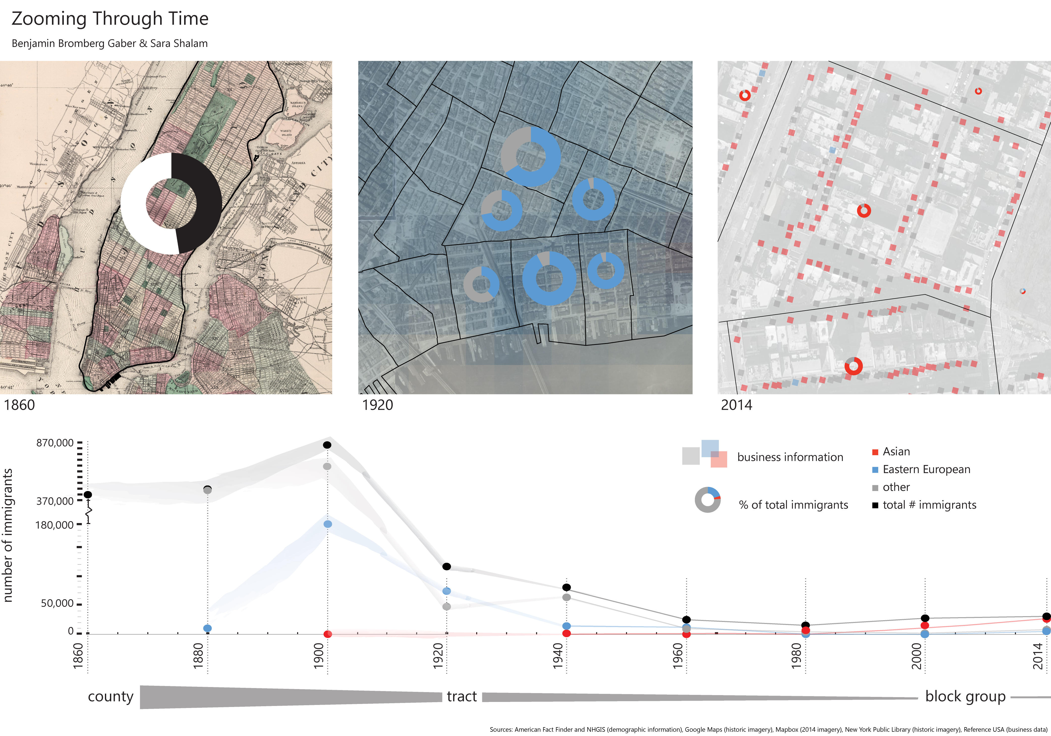
Our interactive map guides the users as they zoom through time, understanding the immigrant experience of the Lower East Side by seeing the groups of people that lived and worked there. Users start in the present day, and as they zoom back in time, information is revealed, with the timeline in the teaser as a guide. In addition to revealing information about the given time period, the different map layers in the background orient users to the year to which they have zoomed. By using similar symbology and related representation techniques despite the changes in resolution, users can understand the progression of the map experience and begin to understand the connection of information across time. Due to the gaps in data collection this map gives form to the inconsistencies of information available through low resolution and fuzzy layers. This lack of data forced the scope of the project to narrow, while requiring creative approaches to representing the informal aspects of the city. The interactive map enables this experience of exploration, in which users can jump between layers, years and different levels of resolution, while the static map allows a greater level of comparison as the different layers of data sit side-by-side. The detailed timeline at the bottom gives the user an overall idea of the trends that occur over time.